Dams and Retaining Walls

Safely operating and long-term monitoring of dams

HydroMapper captures dams and reservoirs in their entirety, providing the solid data foundation needed for thorough structural assessments, continuous monitoring, and sustainable infrastructure decisions.

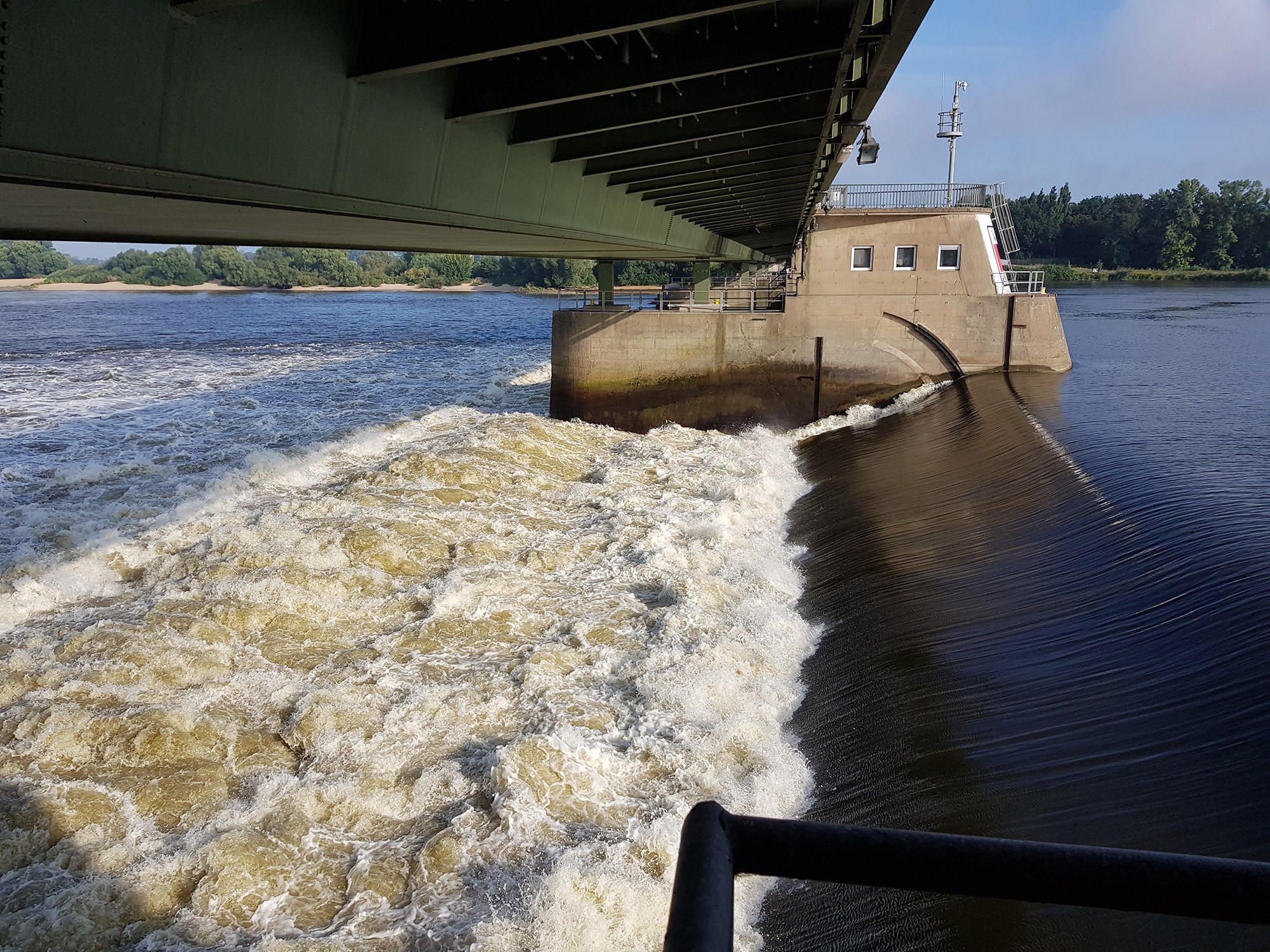
Dam and reservoir wall being measured and surveyed for structural integrity

Dams and Retaining Walls

Safely operating and long-term monitoring of dams

HydroMapper captures dams and reservoirs in their entirety, providing the solid data foundation needed for thorough structural assessments, continuous monitoring, and sustainable infrastructure decisions.

Dam and reservoir wall being measured and surveyed for structural integrity

Dams and Retaining Walls

Safely operating and long-term monitoring of dams

HydroMapper captures dams and reservoirs in their entirety, providing the solid data foundation needed for thorough structural assessments, continuous monitoring, and sustainable infrastructure decisions.

Dam and reservoir wall being measured and surveyed for structural integrity

Dams and Retaining Walls

Safely operating and long-term monitoring of dams

HydroMapper captures dams and reservoirs in their entirety, providing the solid data foundation needed for thorough structural assessments, continuous monitoring, and sustainable infrastructure decisions.

Dam and reservoir wall being measured and surveyed for structural integrity

Challenges in assessing dams and retaining walls

Precise building transparency. Above and below water.

Dams and reservoirs are among the most safety-critical infrastructure assets and must operate reliably over several decades.

Many of these structures are aging and subject to continuous changes due to material fatigue, water load, and environmental factors. At the same time, critical areas—such as underwater zones or foundation structures—remain hidden from direct visual inspection.

Existing measurement and monitoring systems often provide only localized data points. Consequently, a comprehensive, area-wide assessment of the structure's integrity is challenging to achieve.

In practice, this means:

The condition and long-term behavior of the structure are often only partially hidden or unknown. This makes it difficult to detect risks early on, forcing you to prioritize maintenance work under a degree of uncertainty.

Our approach to structural data acquisition

HydroMapper creates a complete and consistent database for dams and reservoirs.

By leveraging modern surveying technologies, structures are captured holistically – both above and below the waterline. Even hard-to-reach areas such as embankments, dam bodies, or underwater structures can be documented with high precision.

The combination of different measurement methods enables comprehensive coverage and provides a valuable complement to existing monitoring systems.

At the same time, HydroMapper's expertise in surveying complex infrastructure translates directly into project execution. Data acquisition is targeted specifically to ensure it is immediately usable for safety assessments, analysis, and long-term planning.

Underwater sonar image of a harbor seabed with scattered debris
Stone masonry arch bridge over a calm river, captured from a low-angle perspective
Excavated riverbank showing soil layer profile and foundation depth

Added value for operations and maintenance

Comprehensive mapping of the structures delivers a new level of data quality for operators.

By combining full-coverage surveying with structured data management, we establish a continuous, end-to-end understanding of asset health – even across large and complex structures.

HydroMapper enables:

  • sound condition assessment of safety-critical structures

  • early detection of structural changes and potential risks

  • optimized prioritization of maintenance workflows

  • integration with existing monitoring systems using full-coverage data datasets

All data is delivered within a unified environment, making it easily accessible for all project stakeholders.

In practice, this means:

Greater operational safety, a reliable basis for decision-making, and more efficient planning of measures throughout the entire lifecycle of your structures.
Decorative dot pattern background

Discuss your project

Looking to gain a deeper understanding of your dam's structural health, or need to make well-informed decisions for its operation and maintenance?

Let's discuss the technical details of your project.

InfraCloud digital infrastructure platform displaying real-time port scan data
Decorative dot pattern background

Discuss your project

Looking to gain a deeper understanding of your dam's structural health, or need to make well-informed decisions for its operation and maintenance?

Let's discuss the technical details of your project.

InfraCloud digital infrastructure platform displaying real-time port scan data
Decorative dot pattern background

Discuss your project

Looking to gain a deeper understanding of your dam's structural health, or need to make well-informed decisions for its operation and maintenance?

Let's discuss the technical details of your project.

InfraCloud digital infrastructure platform displaying real-time port scan data
Decorative dot pattern background

Discuss your project

Looking to gain a deeper understanding of your dam's structural health, or need to make well-informed decisions for its operation and maintenance?

Let's discuss the technical details of your project.

InfraCloud digital infrastructure platform displaying real-time port scan data
Logo
Phone contact icon

Clone component

Copied to clipboard

+49 40 99 99 862-00

Map pin icon

Veritaskai 6, 21079 Hamburg, Germany

Email contact icon

Clone component

Copied to clipboard

info@hydromapper.de

© 2026 HydroMapper GmbH

The HydroMapper team live at our industry trade show booth
Logo
Phone contact icon

Clone component

Copied to clipboard

+49 40 99 99 862-00

Map pin icon

Veritaskai 6, 21079 Hamburg, Germany

Email contact icon

Clone component

Copied to clipboard

info@hydromapper.de

© 2026 HydroMapper GmbH

The HydroMapper team live at our industry trade show booth
Logo
Phone contact icon

Clone component

Copied to clipboard

+49 40 99 99 862-00

Map pin icon

Veritaskai 6, 21079 Hamburg, Germany

Email contact icon

Clone component

Copied to clipboard

info@hydromapper.de

© 2026 HydroMapper GmbH

The HydroMapper team live at our industry trade show booth