Structure Mapping

InfraCapture 360 Digital mapping of indoor spaces and industrial facilities

With InfraCapture 360, Hydromapper delivers a powerful solution for the complete digital capture of indoor spaces, technical assets, and industrial environments. Utilizing 360° scanning technology and high-resolution panoramic imagery, we document complex structures in precise detail, providing you with a consistent, comprehensive spatial model of your spatial data.

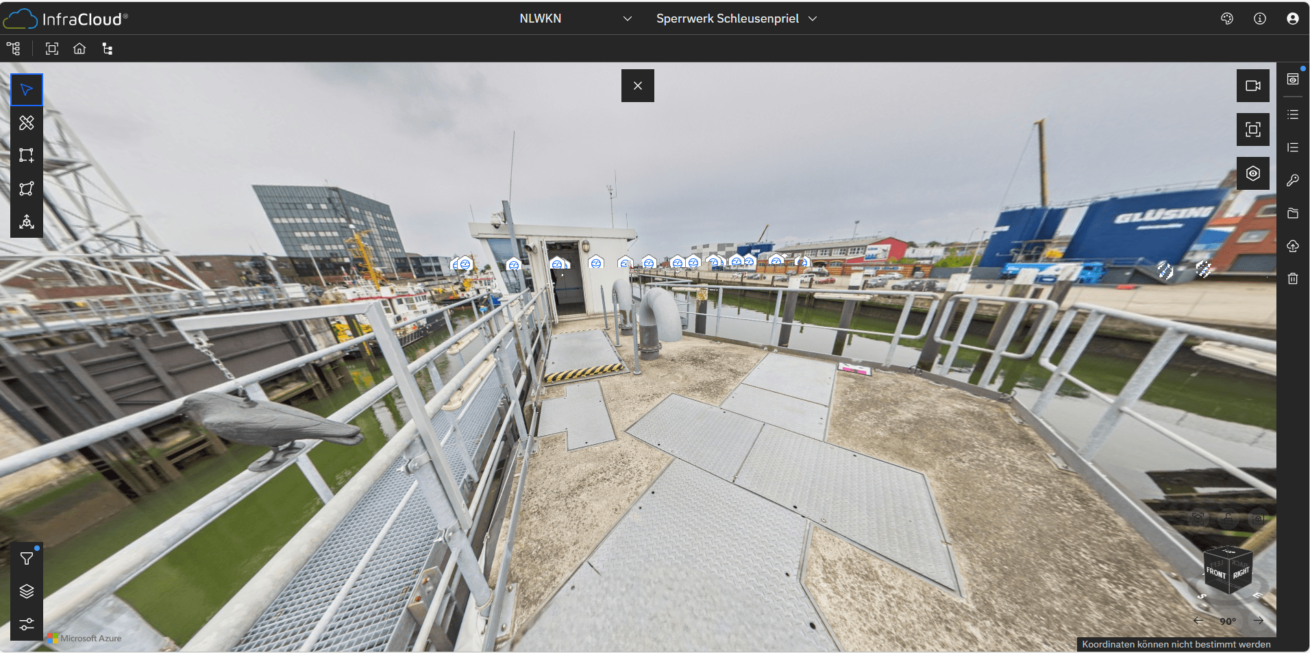
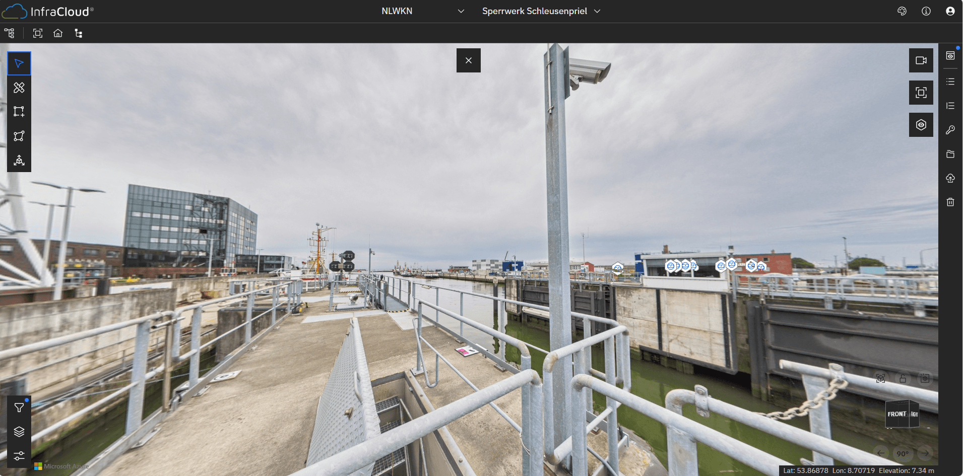
Comprehensive 360° Capture

INfraCapture 360 captures environments from every perspective, generating immersive, navigable representations of reality. Complemented by precise spatial referencing, it creates a structured data foundation that enables both intuitive visual orientation and metric analysis.

Ideal for Complex Facilities and Indoors

Whether industrial halls, production facilities, engine rooms, technical infrastructure, or existing buildings – InfraCapture 360 is particularly suited for highly structured environments. The complete visual documentation supports planning, maintenance, operation, and retrofitting alike.


Combining Panoramas and Spatial Data

The integration of 360° panoramic imagery and spatial scan data allows for intuitive navigation through captured environments. Users can perform measurements, analyze details, and evaluate conditions remotely without having to be physically on site.

Efficient Data Acquisition and Documentation

The mobile and flexible capturing process significantly reduces on-site effort, enabling rapid digitization of even large-scale facilities. The captured data serves as a reliable foundation for as-built documentation, facility management, safety analyses, and project planning.


Seamless Integration into Digital Workflows

The captured data integrates smoothly into your existing systems and platforms, providing a centralized hub for analysis, visualization, and collaboration – for instance, within the InfraCloud.

InfraCapture 360 – rendering indoor spaces fully visible and digitally tangible

HydroScan - Patented Underwater Surveying Technology

With HydroScan, HydroMapper is setting new standards for the precise, efficient, and safe inspection of underwater structures.

HydroScan - Patented Underwater Surveying Technology

With HydroScan, HydroMapper is setting new standards for the precise, efficient, and safe inspection of underwater structures.

HydroScan - Patented Underwater Surveying Technology

With HydroScan, HydroMapper is setting new standards for the precise, efficient, and safe inspection of underwater structures.

HydroScan - Patented Underwater Surveying Technology

With HydroScan, HydroMapper is setting new standards for the precise, efficient, and safe inspection of underwater structures.

HD Mapping – High-Resolution 3D Capture of Surface Structures

By utilizing state-of-the-art camera systems and intelligent evaluation algorithms, we generate highly realistic 3D models with exceptional resolution.

HD Mapping – High-Resolution 3D Capture of Surface Structures

By utilizing state-of-the-art camera systems and intelligent evaluation algorithms, we generate highly realistic 3D models with exceptional resolution.

HD Mapping – High-Resolution 3D Capture of Surface Structures

By utilizing state-of-the-art camera systems and intelligent evaluation algorithms, we generate highly realistic 3D models with exceptional resolution.

Mobile Mapping – Millimeter-accurate 3D mapping of overwater structures

Our mobile mapping systems continuously capture spatial data as they move along the object or structure.

Mobile Mapping – Millimeter-accurate 3D mapping of overwater structures

Our mobile mapping systems continuously capture spatial data as they move along the object or structure.

Mobile Mapping – Millimeter-accurate 3D mapping of overwater structures

Our mobile mapping systems continuously capture spatial data as they move along the object or structure.

Mobile Mapping – Millimeter-accurate 3D mapping of overwater structures

Our mobile mapping systems continuously capture spatial data as they move along the object or structure.

HydroInspect – ROV-supported underwater inspection and documentation

HydroInspect ROV systems deliver crystal-clear visual data and sonar-based insights, even in low-visibility, turbid waters.

HydroInspect – ROV-supported underwater inspection and documentation

HydroInspect ROV systems deliver crystal-clear visual data and sonar-based insights, even in low-visibility, turbid waters.

HydroInspect – ROV-supported underwater inspection and documentation

HydroInspect ROV systems deliver crystal-clear visual data and sonar-based insights, even in low-visibility, turbid waters.

HydroInspect – ROV-supported underwater inspection and documentation

HydroInspect ROV systems deliver crystal-clear visual data and sonar-based insights, even in low-visibility, turbid waters.

AeroVision – Photogrammetric 3D Aerial Mapping

Aerial data acquisition enables fast and flexible documentation, even for large-scale or difficult-to-access structures.

AeroVision – Photogrammetric 3D Aerial Mapping

Aerial data acquisition enables fast and flexible documentation, even for large-scale or difficult-to-access structures.

AeroVision – Photogrammetric 3D Aerial Mapping

Aerial data acquisition enables fast and flexible documentation, even for large-scale or difficult-to-access structures.

AeroVision – Photogrammetric 3D Aerial Mapping

Aerial data acquisition enables fast and flexible documentation, even for large-scale or difficult-to-access structures.

InfraCapture 360 – Digital mapping of indoor spaces and industrial facilities

Whether it's industrial halls, production plants, engine rooms, technical infrastructure, or existing buildings – InfraCapture 360 is perfectly suited for highly structured environments.

InfraCapture 360 – Digital mapping of indoor spaces and industrial facilities

Whether it's industrial halls, production plants, engine rooms, technical infrastructure, or existing buildings – InfraCapture 360 is perfectly suited for highly structured environments.

InfraCapture 360 – Digital mapping of indoor spaces and industrial facilities

Whether it's industrial halls, production plants, engine rooms, technical infrastructure, or existing buildings – InfraCapture 360 is perfectly suited for highly structured environments.

InfraCapture 360 – Digital mapping of indoor spaces and industrial facilities

Whether it's industrial halls, production plants, engine rooms, technical infrastructure, or existing buildings – InfraCapture 360 is perfectly suited for highly structured environments.

Logo

Clone component

Copied to clipboard

+49 40 99 99 862-00

Veritaskai 6, 21079 Hamburg, Germany

Clone component

Copied to clipboard

info@hydromapper.de

© 2026 HydroMapper GmbH

Logo

Clone component

Copied to clipboard

+49 40 99 99 862-00

Veritaskai 6, 21079 Hamburg, Germany

Clone component

Copied to clipboard

info@hydromapper.de

© 2026 HydroMapper GmbH

Logo

Clone component

Copied to clipboard

+49 40 99 99 862-00

Veritaskai 6, 21079 Hamburg, Germany

Clone component

Copied to clipboard

info@hydromapper.de

© 2026 HydroMapper GmbH