Ports & quay walls
Get a precise grip on your ports and quay walls for safe, reliable operations
HydroMapper comprehensively captures port infrastructure—both above and below water—providing the precise data foundation needed for reliable condition assessments and sustainable maintenance decisions.

Ports & quay walls
Get a precise grip on your ports and quay walls for safe, reliable operations
HydroMapper comprehensively captures port infrastructure—both above and below water—providing the precise data foundation needed for reliable condition assessments and sustainable maintenance decisions.
Ports & quay walls
Get a precise grip on your ports and quay walls for safe, reliable operations
HydroMapper comprehensively captures port infrastructure—both above and below water—providing the precise data foundation needed for reliable condition assessments and sustainable maintenance decisions.
Ports & quay walls
Get a precise grip on your ports and quay walls for safe, reliable operations
HydroMapper comprehensively captures port infrastructure—both above and below water—providing the precise data foundation needed for reliable condition assessments and sustainable maintenance decisions.
Port Infrastructure Challenges
Precise
building
transparency.
Above and below water.
A major part of port infrastructure lies deep underwater—making it virtually invisible in day-to-day operations. Yet quay walls, sheet piling, and foundation structures constantly face heavy demands over decades of service: rising loads from larger vessels, corrosion, sediment shifts, and structural wear.
A major part of port infrastructure lies deep underwater—making it virtually invisible in day-to-day operations. Yet quay walls, sheet piling, and foundation structures constantly face heavy demands over decades of service: rising loads from larger vessels, corrosion, sediment shifts, and structural wear.
Structural inspections are frequently conducted using diving operations. These are often complex, time-limited, and typically provide only localized snapshots. Furthermore, poor underwater visibility makes accurate assessments even more challenging.
Structural inspections are frequently conducted using diving operations. These are often complex, time-limited, and typically provide only localized snapshots. Furthermore, poor underwater visibility makes accurate assessments even more challenging.
In practice, this means we often lack a complete picture of a structure's actual condition. Consequently, decisions regarding maintenance, operations, or investments have to be made based on limited data.
In practice, this means we often lack a complete picture of a structure's actual condition. Consequently, decisions regarding maintenance, operations, or investments have to be made based on limited data.
Our approach to structural data acquisition
Our approach to structural data acquisition
HydroMapper creates a seamless and robust data foundation for port infrastructure. By combining various surveying methods, we capture structures in their entirety—both above and below water. Even hard-to-reach or previously obstructed areas can be precisely documented.
Through this, HydroMapper's extensive, long-term experience in surveying complex infrastructure flows directly into the project's execution. We capture data in a way that goes beyond mere documentation, ensuring it is highly structured and ready for advanced downstream analysis.


HydroScan – Patented underwater surveying
HydroScan – Patented underwater surveying

HD Mapping – High-Resolution 3D Capture of Surface Structures
HD Mapping – High-Resolution 3D Capture of Surface Structures

Mobile Mapping – Millimeter-accurate 3D mapping of overwater structures
Mobile Mapping – Millimeter-accurate 3D mapping of overwater structures

HydroInspect – ROV-supported underwater inspection and documentation
HydroInspect – ROV-supported underwater inspection and documentation

AeroVision – Photogrammetric 3D Aerial Mapping
AeroVision – Photogrammetric 3D Aerial Mapping

InfraCapture 360 – Digital mapping of indoor spaces and industrial facilities
InfraCapture 360 – Digital mapping of indoor spaces and industrial facilities
A real-world example
A real-world example
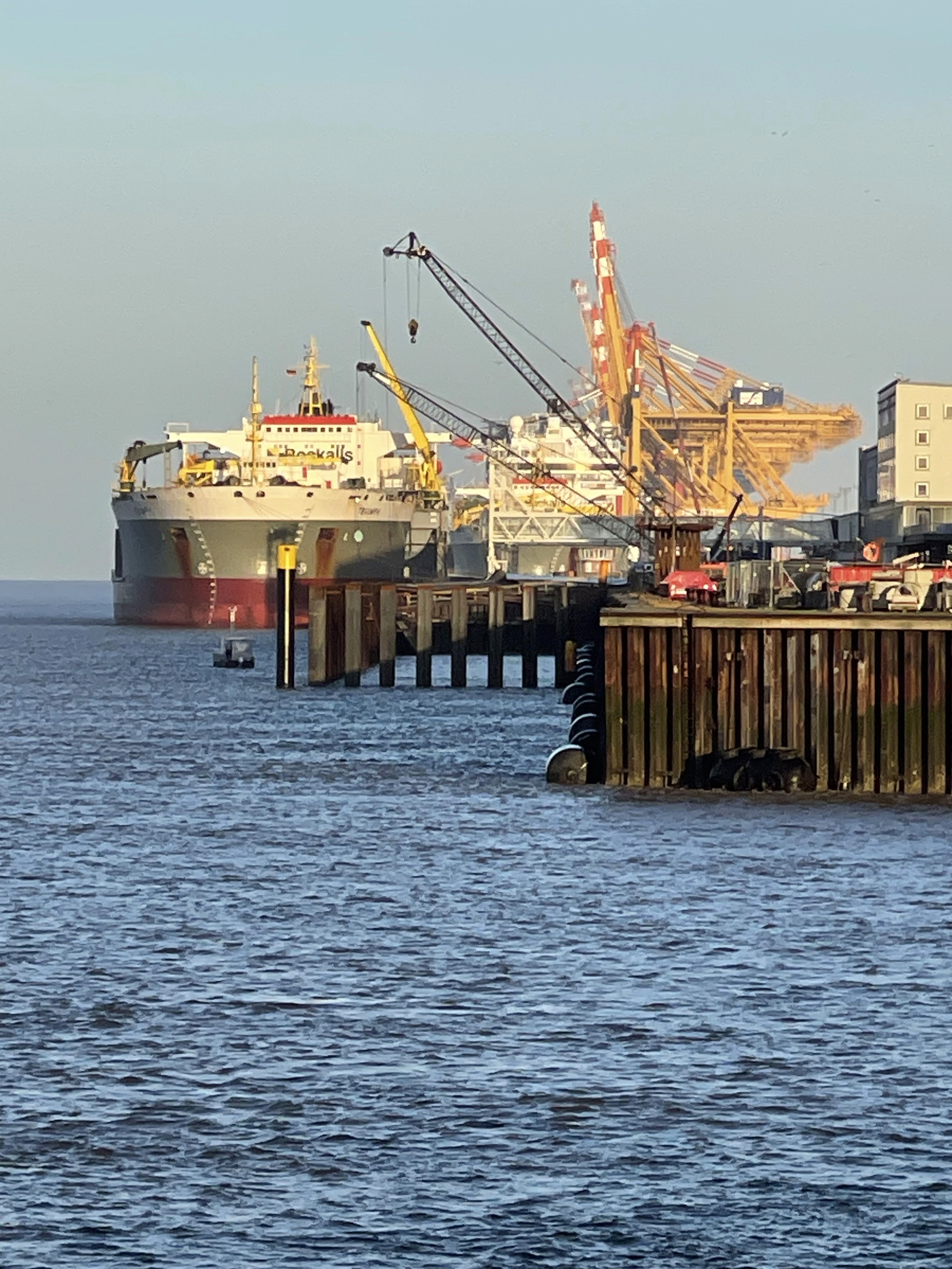
Bremerhaven
Re-evaluation of a quay wall
steel sheet pile
Wall Thickness Measurement
Remaining Service Life Calculation
By accurately measuring and subsequently approximating the bending line, we were able to realistically assess the actual load on the quay wall. This prevented a premature closure and established the foundation for an economically viable continued operation strategy.
Let's discuss your port project
Want to get a deeper understanding of your port infrastructure's condition or make data-driven decisions for maintenance and investments? Let's talk about your project.

Let's discuss your port project
Want to get a deeper understanding of your port infrastructure's condition or make data-driven decisions for maintenance and investments? Let's talk about your project.
Let's discuss your port project
Want to get a deeper understanding of your port infrastructure's condition or make data-driven decisions for maintenance and investments? Let's talk about your project.
Let's discuss your port project
Want to get a deeper understanding of your port infrastructure's condition or make data-driven decisions for maintenance and investments? Let's talk about your project.


Clone component
Copied to clipboard
+49 40 99 99 862-00

Veritaskai 6, 21079 Hamburg, Germany

Clone component
Copied to clipboard
info@hydromapper.de

Clone component
Copied to clipboard
+49 40 99 99 862-00
Veritaskai 6, 21079 Hamburg, Germany
Clone component
Copied to clipboard
info@hydromapper.de
Clone component
Copied to clipboard
+49 40 99 99 862-00
Veritaskai 6, 21079 Hamburg, Germany
Clone component
Copied to clipboard
info@hydromapper.de